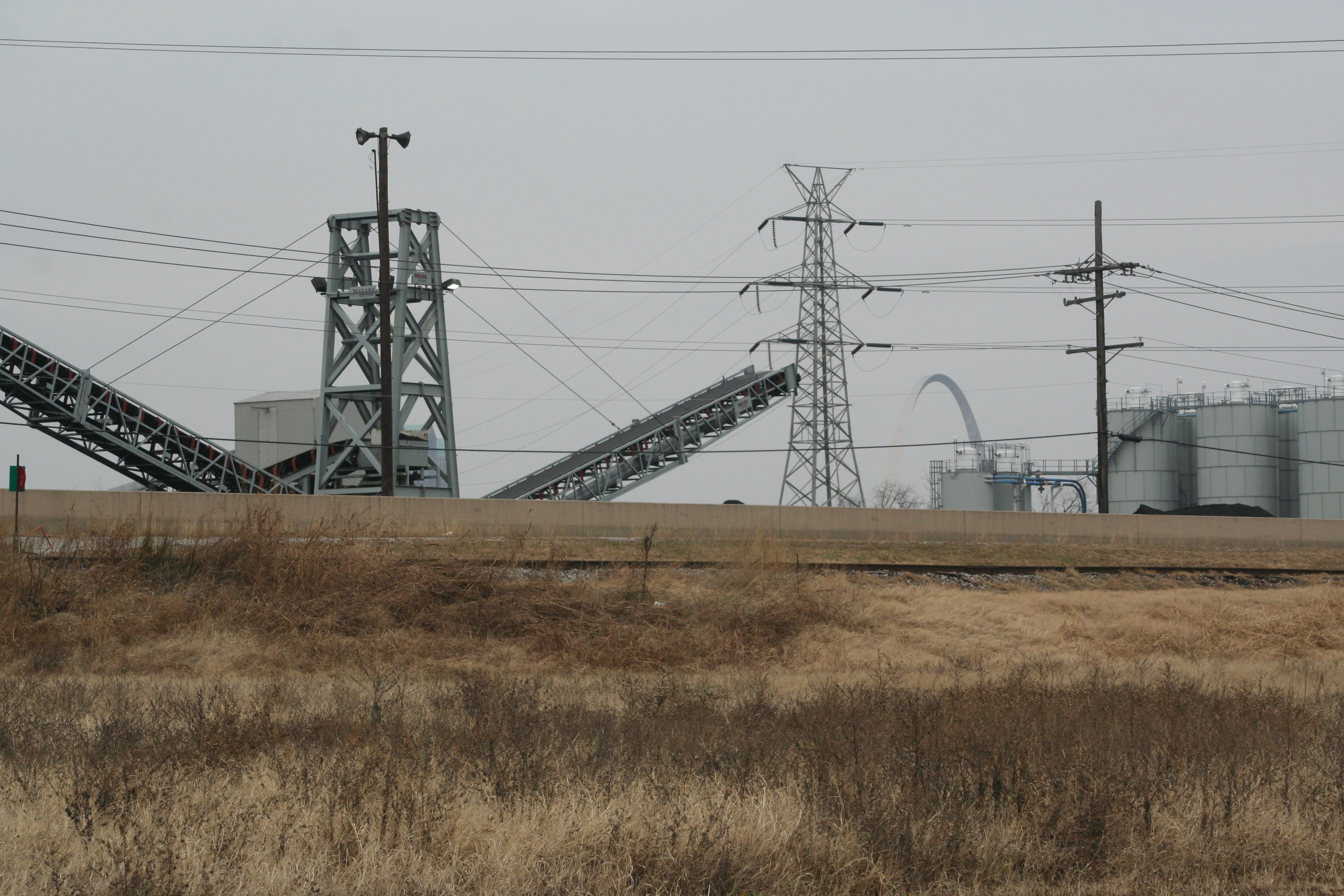
Monsanto-Sauget Superfund
(Sites 1&2- to include-Resource Recovery Group/Clayton Chemical)
Cahokia, Sauget, Illinois
1 Mobile Avenue
Sauget, IL 62201
Latitude: 38.5972740
Longitude: -90.1816870
This is scorched earth. The agricultural giant Monsanto was founded in St. Louis Missouri by John Francis Queeny in 1901. Just across the Mississippi River the Village of Monsanto Illinois was incorporated in 1926 for the sole purpose of environmental regulation negligence and a low tax base. Monsanto was later renamed Sauget in 1968 after the village’s first president Leo Sauget. Sauget consists of mind-boggling toxicity, strip clubs, off track gambling, and industry. The village has a modest population of 159 people of a total of 270,000 in St. Clair County Illinois.
Trying to weed trough the history of this land and the absolute horror of pollution has been like putting together tarred puzzle pieces blind. Many people reading this will already recognize Monsanto as truly one of the most corrupt transnational companies around, but the amount of hazardous waste created and knowingly dumped into over 312 acres neighboring the Mississippi River and 3.5 miles of the aptly named Dead Creek in the East St. Louis area is disturbing.
Monsanto along with the wonderful people at Dow Chemical made their money supplying the United Sates Military with Agent Orange for use in Vietnam, which would be their first attempt at agricultural warfare. Monsanto also produced DDT and was the United States major producer on PCBs until 1977.
Levels of PCB contamination in the area have been measure at 25,000 ppm to 250,000,000 ppm or over 25 million times the acceptable limit for human contact.
Beyond the gruesome aspects of hazardous waste levels is the confusing aspect of who are the responsible parties beyond Monsanto. This is where a local connection comes in; Pharmacia a pharmaceutical subsidiary of Pfizer was formerly a branch of Monsanto and a responsible party in the 4 million dollar clean up of Milwaukee Die Cast. Pharmacia along with Solutia a (Kodak) Eastman Chemical Company accusation all have direct ties to Monsanto and Pfizer. Monsanto, Pharmacia, Solutia and up to 250 different companies are legally being sought as financially responsible for the remediation of the area. Monsanto is directly linked to a minimum of 7 other sites ( 9 total include their name) across the United States.
SAUGET AREA 1 includes three landfills and a backfilled surface impoundment along Dead Creek and segments of Dead Creek that have been altered as a result of industrial waste disposal. Multiple releases of hazardous materials occurred due to shared waste disposal practices of several different companies since the 1930s. Waste discharges have commingled and migrated along Dead Creek to adjacent wetlands. The Site is being proposed to the NPL on the basis that PCBs, cadmium, copper, lead, mercury, and zinc have been documented in the wetland and endangered species habitat. Areas 1, 2, and 7 received industrial wastewater from Monsanto and Cerro Copper Company. A removal action of 27,500 tons of sediment, soil, and water were removed at Source 1 in 1990 as a result of a consent decree. The surface pond was backfilled and covered with gravel. In 2000, samples taken at Source 2 contained PCBs at 24,290 ppm, copper 19,000 ppm, and zinc 26,000 ppm.
Roughly 6,000 feet of wetland frontage have been impacted and over 11 miles of wetland frontage are subject to contamination. Hazardous substances from the source areas have been documented in the wetland adjacent to Source 3. The wetland flows into Old Prairie duPont Creek, the Cahokia Chute of the Mississippi River, and eventually to the main passage of the Mississippi River.
SAUGET AREA 2 consists of four landfills and four backfilled lagoons. The four sludge-dewatering lagoons were used to treat wastewater from area industries from the early 1950s to the late 1980s. Landfill (R) is located directly next to the Mississippi River and was used to dispose of chemical waste from 1957 to 1977.
Sampling at the Site has indicated levels of hazardous substances in all sources, including benzene at concentrations up to 10,000 ug/kg, polychlorinated biphenyls (PCBs) at concentrations up to 25,000,000 ug/kg, 4,4′-Dichlorodiphenyethlene (DDE) at 270 ug/kg, phenol at 2,300,000 ug/kg, and lead at 728 ug/kg. Chlorobenzenes, chlorophenols, chloroanilines, nitroanilines, and metals were found on the property, in groundwater beneath the property, and in Mississippi River sediments adjacent to the Sauget 2 property
In 1993, a flood exposed numerous drum containers on the east bank of the Mississippi River (Site Q), resulting in floodwater coming in direct contact with hazardous substances, including PCBs at concentrations up to 110,000 ug/kg. These drums contained waste with arsenic concentrations of 138 mg/kg and lead concentrations at 3,740 mg/kg. The EPA conducted a removal action at the northern portion of Site Q in 1995 to stabilize the area battered by floodwaters.
In 1999 lead was sampled in groundwater beneath the property at 238 ug/L. PCB levels were documented as high as 19 ug/L, and 4,4′-DDE levels as high as 0.52 ug/L. In response, EPA initiated a time-critical removal in which over 3,271 drums of waste and hazardous materials and 17,032 tons of contaminated soil were removed from the western edge of the property, directly adjacent to the Mississippi River. Due to the extensive amount of contamination, the removal action could not address all the contamination on Sauget Area 2 Site Q property. Samples collected in 2000 from the Mississippi River near to the site show elevated levels of chlorobenzene (up to 10,000 ug/kg), 4-chloroaniline (3,300 ug/kg), 1,4-Dichlorobenzene (1, 700 ug/kg), and 4,4′-DDD (14 ug/kg).
Sources:
http://www.epa.gov/superfund/sites/npl/nar1654.htm
http://www.epa.gov/Region5/superfund/npl/illinois/ILD000605790.html
